Details

Itinerary
Barreiros
Ponte Paradela
San Pedro
A Ermida

Difficulty
Middle-low

Distance
14 Km.

Time
4 hours
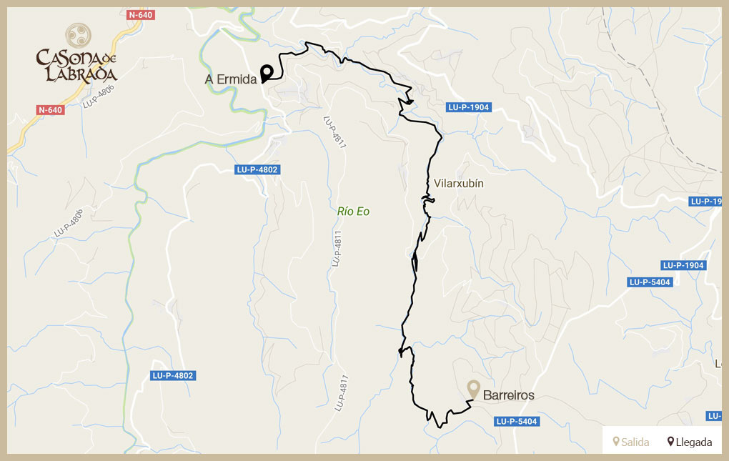
The route
Stretch Barreiros - Ponte Paradela
The beginning of the first section of the route is located at 785 meters altitude, in the village of Barreiros, belonging to the parish of San Pedro de Bogo. The absence of arboreal vegetation during the first 600 meters of the road, allows us to admire an impressive panoramic view of the lush forest in which runs the Route of the Reigadas
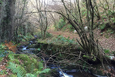
The road turns sharply to the right to enter a mass of pines and then, we can see the characteristic vegetation of the forest or fraga, composed of oak, chestnut, hazel and holly, which will be accompanied by an abundant tapestry of breccias, ferns, cranberries, fungi and lichens that caress the rocks of the numerous streams and waterfalls

Stretch Ponte Paradela - Ferrería de San Pedro
The second section starts 1.8 km from Vilarxubín, belonging to the parish of San Pedro de Bogo, and 410 meters above sea level. After the first 100 meters, which pass by asphalt road, we turn to the left to enter the Vilarxubín frog.
The path runs above the river Reigadas, with a large leafiness of vegetation

After about 2.5 km we reach the end of the forest, descend to the Ferrería de Bogo, located in the parish of San Pedro de Bogo, which was founded in 1534 by the Hidalgo Pedro de Miranda, for the exploitation of the iron riches of their lands from the motor force of the river that gives name to this hiking route.
Stretch Ferrería de San Pedro - A Ermida
The third section starts at 210 meters altitude, at the Bogo Ferrería. The vegetation that we will find in this route is made up of conifers, autochthonous forest and pastures. We will visit the towns of Machuco, Muiñou and Panturreira, following the signs that mark the route. After walking 3.6 km for this last section, we arrive at the place of A Ermida, parish of San Xulián de Vilaboa, where the Ruta de las Reigadas ends.
Fuente: Concello de A Pontenova