Details


Itinerary
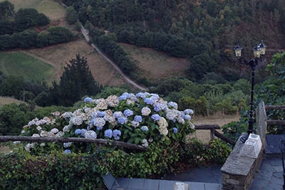
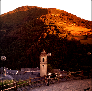
Taramundi
Sierra de Eiroá
Piñeiro
Galiñeiros
Mazo de Bres
Loútima
Bres
Aguillón
Llan
Taramundi

Difficulty
Low

Distance
13 Km.

Time
3 hours & 50 minutes
The Route
We start the route next to the Hotel La Rectoral, in the upper part of Taramundi, along a concrete path up to a water tank, next to a crossroads of forest tracks. We take the one on the left, which ascends in a northerly direction through a forest of pines and eucalyptus interspersed with chestnut trees and oaks. This road leads us to a concrete track, through which we continue the ascent to reach the top of the Sierra de Eiroá, in the area known as Chao do Marco, part level where we find ourselves with grasslands, wild pines and broad heathland

At this point we find a junction where 3 roads converge, one on our right, another that continues straight ahead, and a third on the left. The main route continues to the right, but it is possible to continue straight to the border with the council of San Tirso de Abres, where you can enjoy some excellent views
We continue the route along the track on the right, and after a few meters we come to another junction where we take the path that continues straight ahead, which descends slightly. At the next fork we also continue straight ahead. A few meters away again we find another crossroads, where we now take the track that descends sharply to the right, which leads us to Piñeiro.
Once here we have two options.
The first and shorter is to cross the houses of the town, by a road that descends of pronounced form. At the crossroads that we find below, we always take the descendants, and zigzagging we arrive at Aguillón. Once here we cross the road to go to the old school of the town, point of union with the other alternative, and where we take the paved road on the right to return to Taramundi going through Llan .
The second option is to take the track that starts to the left, through which we will continue for a long stretch that runs along the slope of the Sierra, and from which we have good views of Llan and Valín, on the opposite side of the valley. Finally the track begins to descend and we arrive at the first houses of the village of Os Galiñeiros.
At this point we turn right, taking the paved road, which we descend briefly because at the first crossroads we find, where the road turns sharply to the left, we take the dirt path that starts on the right , towards the Mazo de Bres. From this point we can see on our left the villages of Loútima and Bres.
Once in the Bres Mazo, we continue between the houses of the nucleus, and continue along the paved road to the main road AS-21, which connects Vegadeo and Taramundi
From there we descend to the right along the asphalted road until we reach the old village school, where we continue to the left also by asphalt road. At that point we can make a stop in the recreational area, which is located between this road and the river Cabreira.
We continue leaving behind the rest area of Aguillón and continue towards Llan, where, after crossing the first district, that of the Cernada , we ascend slightly following the road. Once we reach the houses of the main nucleus, we take a concrete track to the right that leads us to Taramundi, descending first abruptly to a bridge through which we cross the river, and then ascending to the southern part of the village, behind the municipal sports center.
Source: Taramundi City Council